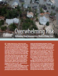
Sea level is rising and increasing the risk of destructive flooding events during powerful coastal storms. At the same time, increasing coastal development and a growing population are putting more people and more property in harm's way.
This risky pattern of development is being reinforced by the taxpayer-subsidized National Flood Insurance Program, which sets artificially low insurance rates that do not reflect the true risks to coastal properties. When major disasters strike, taxpayers nationwide are left liable for billions of dollars in insurance claims and disaster relief.
We urgently need to reform our insurance system to more effectively manage and reduce these coastal risks—risks that are projected only to grow in a warming world.
- Sea level rise amplifies storm surges during powerful storm events, contributes to shoreline erosion and degradation, steadily inundates low-lying areas, and raises flooding risks from extra-high normal tides, all of which increase the likelihood of property damage and destruction.
- Global average sea level is likely to increase 6 - 16 inches by 2050, and up to 6.6 feet by 2100, primarily in response to global warming.
- Sea level rise is accelerating, especially along the U.S. East Coast and Gulf of Mexico, which have seen much higher and faster rates of sea level rise than the global average.
- In 2012, the insured value of residential and commercial property in the coastal counties of the 18 Atlantic and Gulf coast states was $10.6 trillion, with New York and Florida topping the list at $2.9 trillion apiece.
- The National Flood Insurance Program (NFIP) is now essentially the only provider of flood insurance for homeowners and small businesses. Created by Congress in 1968, NFIP is administered by the Federal Emergency Management Agency (FEMA).
- As of 2012, NFIP provided over 5.6 million insurance policies, with approximately $1.25 trillion in insured assets.
- Artificially low rates. NFIP's subsidized insurance rates do not reflect the true risk of coastal flooding events and are too low to cover the program's cost, especially during years with exceptionally high damages. As of November 2012, NFIP was more than $20 billion in debt, a number likely to rise to nearly $30 billion once all Hurricane Sandy claims are settled.
- Flood maps that do not reflect the true risks of coastal flooding. The flood-risk maps created by FEMA to help determine insurance rates fail to account for future sea level rise and long-term erosion, which will create increased risks to many coastal properties.
- Repeated payouts to the same high-risk properties. Insurance claims on properties repeatedly damaged by flooding, or "repetitive losses," have accounted for about a quarter of all NFIP payments since 1978. Currently, repetitve loss properties represent only 1.3 percent of NFIP policies but are expected to account for 15-20 percent of future losses.
- Exemptions for certain high-risk properties. NFIP's "grandfathering" clause exempts certain properties from complying with protective requirements and allows them to avoid paying higher insurance rates even if the location is rezoned with a higher flood risk.
The Biggert-Waters Flood Insurance Reform Act of 2012 is taking some important first steps to remedy some of these shortcomings in the National Flood Insurance Program. It should be implemented as scheduled, though additional steps outlined in the report should be taken to further minimize our coastal risks in a world of rising seas.